
NYC Water Supply

New York City Water Supply System

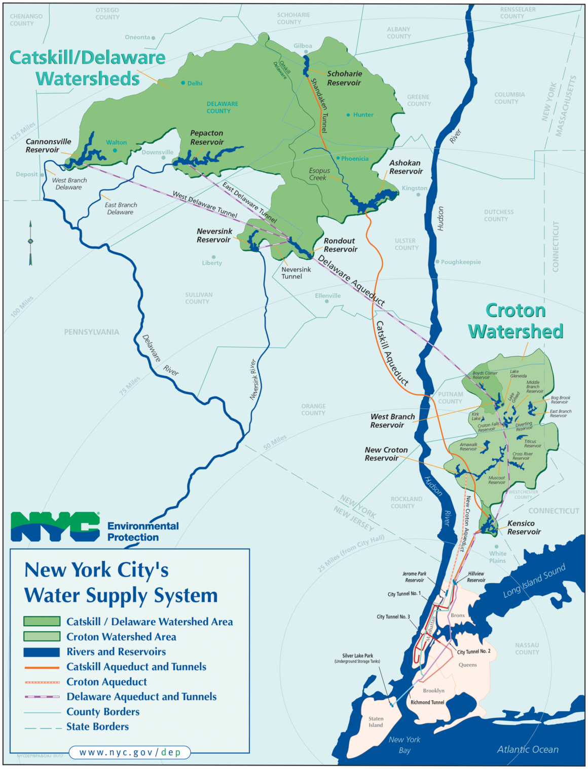
New York City’s water supply is one of the largest surface water systems in the world — and one of only five in the U.S. that still delivers unfiltered surface water. Every day, the system provides 1.1 billion gallons of safe drinking water to more than nine million people (nearly half of New York State’s population).

The Watersheds

NYC’s water comes from two primary sources:

Catskill / Delaware Watersheds
1,597 sq. miles, West of the Hudson
Croton Watershed

375 sq. miles, East of the Hudson

Together, they cover 1,972 sq. miles (about 1.2 million acres) and include 19 reservoirs and 3 controlled lakes.

Catskill/Delaware Watersheds (West of Hudson)

Location

Delaware, Greene, Schoharie, Sullivan, and Ulster counties 

Area

1,597 sq. miles

Supplies

~90% of NYC’s daily water 

Characteristics

Largely rural, small to mid-sized dairy/vegetable farms, ~75% forested (85% privately owned) 

Reservoirs (6)

Ashokan, Cannonsville, Neversink, Pepacton, Rondout, Schoharie

See our program footprint map and check to see if you are in the NYC Watershed here

Croton Watershed (East of Hudson)

Location

Westchester, Putnam, and Dutchess counties (NY) + Fairfield County (CT) 

Area

375 sq. miles

Supplies

~10% of NYC’s daily water (up to 30% in droughts or emergencies), the Croton Watershed is filtered

Characteristics

Predominantly forested; mix of farms, horses, and horticulture under development pressure 

Reservoirs (13)

Amawalk, Bog Brook, Cross River, Croton Falls, Diverting, East Branch, Kensico, Middle Branch, Muscoot, New Croton, Titicus, West Branch, Boyds Corner

Controlled Lakes (3)

Kirk Lake, Lake Gilead, Lake Gleneida

Click to expand
Are you in the NYC Watershed?

View our boundary map.